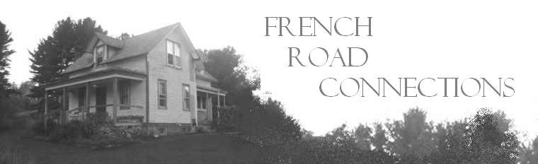
 Years ago, before I gave birth to Anna, I used to find myself on our roof every September, straddling the peak, looking down at my family in the yard. Usually my husband was shouting directions to me about our TV antenna or some other job that needed doing, but sometimes I just took advantage of the ladder leaning against the backside of the house to scoot up and see what the world looked like from on high. The September sun lit up my family from the same angle as my perspective; they seemed to have the world's spotlight on them.
I don't do this much anymore. When we put the addition on our house we put a new roof on that half of the house. You don't traipse all over a new roof like you do a roof that's going to be replaced soon. When cable internet became available I finally bit the bullet and got cable TV, so now we don't have a TV antenna to maintain. With older teenagers, I hardly see my family all in one place at all, let alone from a bird's eye view.
But here's what we look like. This is an image from Google Earth, a new download from Google that accesses a huge cache of satellite photos to make an easy to use picture of the entire earth.
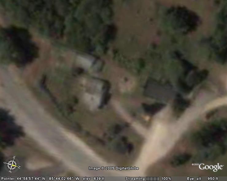 Our house is the largest building, the one with the two tone roof and the driveway/walkway seeming to point at it. The barn is directly behind the house. Richard's shop is the dark-roofed building on the right. The odd dark blob in front of his shop is our big pine tree, melded with its own shadow in the image. Between the shop and our house is a bare spot in the yard with a dark dot in the middle of it. The dot is Anna's tower, the one that is behind her in the sunflower picture of the last post.
 I deduce that this picture was taken in late June, judging from the shadows and the fact that my garden is already shrouded in weeds. If I read the documentation I could find out how often the pictures are updated, but none of us have read the documentation yet. It is too much fun to just type in an address and go there.
And you do go there. Anna has been following the roads from our house and checking out her friends' houses and her favorite beaches. She types in "Boulder, Colorado" and the image pulls back from our house and the earth below spins until it zooms in on Boulder. She sees much of the same landscape that she saw while actually flying there. She can go to Africa or Hawaii or Chicago the same way.
Not all neighborhoods are depicted in such detail. Just north of us, in Leland proper, the image is just different colored green pixels. My folks' house in Lockport, NY is a detailed image, but older, with no leaves on the trees.
Google Earth seems to have features aimed at prospective tourists, but they fall short in our area. Asking it to mark restaurants, it tells us that you can eat at a Ben Franklin's in Lake Leelanau. There is no Ben Franklin's in Lake Leelanau, and I've never been to any Ben Franklin's that served food. Oh well, when you live in a rural area you are forever having to deal with city people's preconceptions.
Seeing our house from above (and knowing that anyone else can see it) raises some interesting possibilities. Richard wants to write a message in the driveway. I'm wondering how long before farmers are planting corporate logos into their cornfields. We are both inclined to do something highly visible in the yard so that we can see how long it takes to update. Maybe we should just finish the roof.
Google Earth is free. You have to download the program from earth.google.com.
2 comments:
Coongratulations on 1000 hits, Susan! And many more!
Shelagh
i sure like you new photo -- big improvement over the 'sleepy time' one from before!!
Your Dad
Post a Comment